The Library is pleased to announce two new data resources are available to the campus community: Planet and SHELDUS™.
Planet
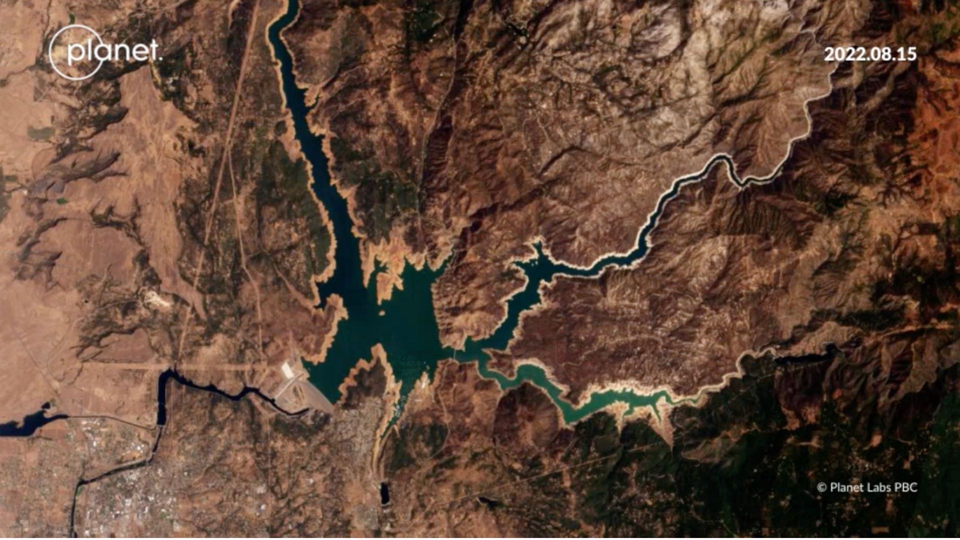
UC San Diego recently obtained a campus-wide license to Planet satellite imagery. Planet provides daily satellite images of the Earth’s land surfaces and coastal areas. Natural color, near infra-red and other multi-channel imagery products are available with 5m, 3.7m, and 50cm ground pixel resolution. Images are exportable to GIS systems and can be viewed and analyzed using Planet’s website and tools. PlanetScope (3.7m) satellite images are available daily, starting in 2014. SkySat (50cm) images are available for selected areas and time periods, starting in 2016. RapidEye (5m) is from 2009-2014. Learn more in our LibGuide.
SHELDUS™
The Spatial Hazard Events and Losses Database for the United States (SHELDUS) is now available to all UC San Diego affiliates. SHELDUS™ is a county-level hazard data set for the U.S. and covers natural hazards such as thunderstorms, hurricanes, floods, wildfires and tornadoes as well as perils such as flash floods, heavy rainfall and more. The database contains information on the date of an event, the affected location (county and state) and the direct losses caused by the event (property and crop losses, injuries, and fatalities) from 1960 to present. To access and download SHELDUS data, users must create an account with their UC San Diego email address. Learn more in our Finding Data: Environment, Climate, & Energy LibGuide.
If you still have questions after reviewing the content in each LibGuide, please feel free to set up a consultation with our Librarians Amy Work or Stephanie Labou.