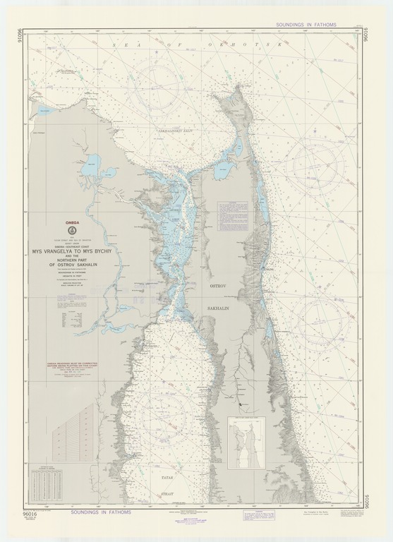
Asia : Tatar Strait and Sea of Okhotsk : Soviet Union : Siberia-southeast coast : Mys Vrangelya to Mys Bychiy and the northern part of Ostrov Sakhalin

- Collection
- Creation Date
- 1968-08-23
- Date Issued
- 1986-08-23
- Publisher
- Note
-
From Japanese and Russian surveys to 1921
Relief shown by contours and spot heights; depths shown by soundings; Mercator projection
- Geographics
- Topics
- Cartographics
Polygon: 55,138.6666667 55,145 49.5,145 49.5,138.6666667 55,138.6666667
Formats
View formats within this collection
- Language
- No linguistic content; Not applicable
- Series
-
6th edition, No. 96016
- Digital Origin
-
reformatted digital
- Copyright
-
Public Domain (US)
Use: This work is available from the UC San Diego Library. This digital copy of the work is intended to support research, teaching, and private study.
Constraint(s) on Use: This work may be used without prior permission.
- Digital Object Made Available By
-
UC San Diego Library, UC San Diego, La Jolla, CA 92093-0175 (https://library.ucsd.edu/dc/contact)
- Last Modified
2022-11-02