Hurricane Dataset for Deep-Hurricane-Tracker model
- Collection
- Cite This Work
-
Kim, Sookyung (2020). Hurricane Dataset for Deep-Hurricane-Tracker model. In Lawrence Livermore National Laboratory (LLNL) Open Data Initiative. UC San Diego Library Digital Collections. https://doi.org/10.6075/J0862DZ8
- Description
-
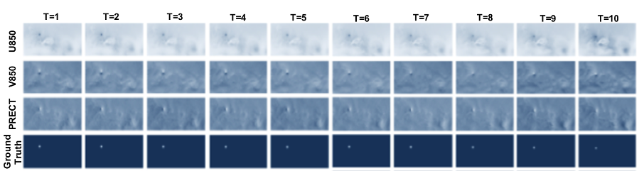
We use 20-year-long records from 1996 to 2015 of Community Atmospheric Model v5 (CAM5) dataset. It contains snapshots of the global atmospheric states for every three hours (1 timestep = 3 hours). Each snapshot contains multiple physical variables among which we use the six most important climate variables to define hurricane from scientific literature, such as PSL (Sea level pressure), U850 (Zonal wind), V850 (Meridional wind), PRECT (Precipitation), TS (Surface temperature), QREFHT (Reference high humidity) by order. From global scaled CAM5 reanalysis data, we only used data for the region around the Northern hemisphere which is 180 degree to 340 degree longitude and 0 degree to 60 degree latitude. For the purpose of training proposed tracking model, we fixed time length as 10 (which is 30 hours long). The input image size is 128 times 257 pixels with around 0.50 degree (around 50.0 km) resolution. Basically, the file contains multiple spatio-temporal hurricane data (video) channeled by 6 climate variables with time length 10. All climate variables are normalized between 0 and 1 accordingly (each channel has max value as 1 and min value as 0).
- Scope And Content
-
The format of dataset is numpy array. The Source of data is from https://www.earthsystemgrid.org/dataset/ucar.cgd.ccsm4.cam5.1.amip.1d.002.html
The details of input data, “hurricane_image_train.npy” and “hurricane_image_test.npy”, are as follows.
shape: (3408, 10, 128, 257, 6)
Axis; Description; Size
0; Number of hurricane videos; 87837
1; Time; 10 (=30 hours)
2; Width; 128 (= 64 degree = 6400 km)
3; Height; 257(= 128.5 degree = 12850 km)
4; Climate variables; 6 (by order: ['PSL','U850','V850','PRECT','TS','QREFHT'] )
As ground truth hurricane location in Input data, we used the corresponding TECA (*Byna, Surendra, et al. "Teca: Petascale pattern recognition for climate science." International Conference on Computer Analysis of Images and Patterns. Springer, Cham, 2015.: https://link.springer.com/chapter/10.1007/978-3-319-23117-4_37*) labels. The TECA labels contain spatial coordinate (latitude, longitude) of each hurricane and the diameter of hurricane-force winds. We synthesize the ground-truth density maps as the same size with input data based on Gaussian mixtures.
The details of input data, “hurricane_label_train.npy” and “hurricane_label_test.npy”, are as follows.
shape: (3408, 10, 128, 257, 1)
Axis; Description; Size
0; Number of hurricane heatmap; 87837
1; Time; 10 (=30 hours)
2; Width; 128 (= 64 degree = 6400 km)
3; Height; 257(= 128.5 degree = 12850 km)
4; Climate variables; 1 (Pixel-level probability that hurricane exists on that location: value between 0~1) - Creation Date
- 2018-09
- Date Issued
- 2020
- Author
- Funding
-
Earth System Grid Federation (ESGF) Project and Task used for working with this data: 40128 / SCW1480-ESGF.
- Geographic
- Topics
Formats
View formats within this collection
- Language
- English
- Identifier
-
Identifier: Sookyung Kim: https://orcid.org/0000-0003-2578-9530
- Related Resources
- Kim, Sookyung, et al. "Deep-hurricane-tracker: Tracking and forecasting extreme climate events." 2019 IEEE Winter Conference on Applications of Computer Vision (WACV). IEEE, 2019. https://doi.org/10.1109/WACV.2019.00192
- CAM5 data: https://www.earthsystemgrid.org/dataset/ucar.cgd.ccsm4.cam5.1.amip.1d.002.html
- National Hurricane Center Data Archive: https://www.nhc.noaa.gov/data/
- GitHub repository: https://github.com/kim79sookyung/WACV
- Byna, Surendra, et al. "Teca: Petascale pattern recognition for climate science." International Conference on Computer Analysis of Images and Patterns. Springer, Cham, 2015. https://doi.org/10.1007/978-3-319-23117-4_37
- Meehl, Gerald A., et al. "Climate change projections in CESM1 (CAM5) compared to CCSM4." Journal of Climate 26.17 (2013): 6287-6308." https://doi.org/10.1175/JCLI-D-12-00572.1
- Earth System Grid Federation (ESGF): https://esgf-node.llnl.gov/projects/esgf-llnl/
Primary associated publication
Source data
Software
Reference
Other resource
- License
- Rights Holder
- Lawrence Livermore National Laboratory
- Copyright
-
Under copyright (US)
Use: This work is available from the UC San Diego Library. This digital copy of the work is intended to support research, teaching, and private study.
Constraint(s) on Use: This work is protected by the U.S. Copyright Law (Title 17, U.S.C.). Use of this work beyond that allowed by "fair use" or any license applied to this work requires written permission of the copyright holder(s). Responsibility for obtaining permissions and any use and distribution of this work rests exclusively with the user and not the UC San Diego Library. Inquiries can be made to the UC San Diego Library program having custody of the work.
- Digital Object Made Available By
-
Research Data Curation Program, UC San Diego, La Jolla, 92093-0175 (https://lib.ucsd.edu/rdcp)
- Last Modified
2023-06-06