Plans on the coast of Sakhalin (Karafuto) Island
 Island")
- Collection
- Description
-
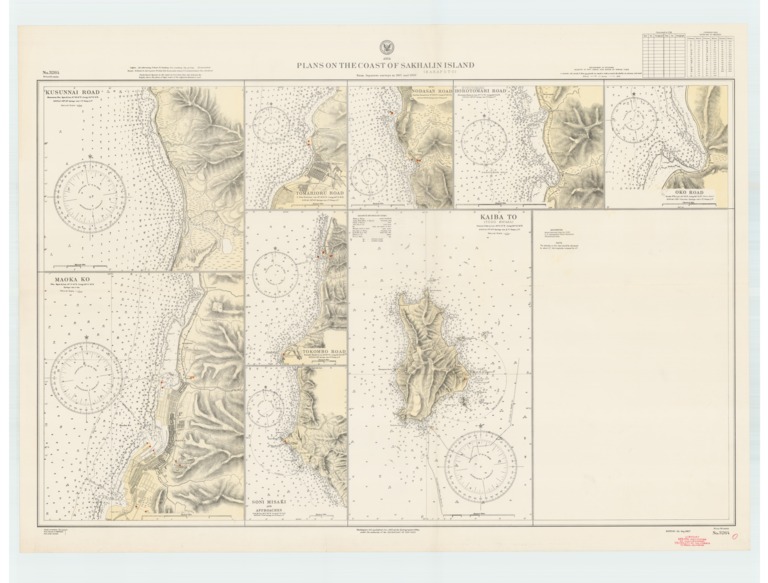
Kusunai Road; Oko Road; Maoko Ko; Tomarioru Road; Tokombo Road; Soni Misaki and approaches; Kaiba To (Todo Shima); Horotomari (Portomari) Road
- Creation Date
- 1919-12-01
- Date Issued
- 1937-05-01
- Publisher
- Note
-
From Japanese surveys in 1907 and 1908
Relief shown by contours and spot heights; depths shown by soundings and isolines
- Geographics
- Topics
- Cartographics
Polygon: 48.02,141.18 48.02,142.22 46.07,142.22 46.07,141.18 48.02,141.18
Formats
View formats within this collection
- Language
- No linguistic content; Not applicable
- Series
-
3rd edition, No. 3264
- Digital Origin
-
reformatted digital
- Copyright
-
Public Domain (US)
Use: This work is available from the UC San Diego Library. This digital copy of the work is intended to support research, teaching, and private study.
Constraint(s) on Use: This work may be used without prior permission.
- Digital Object Made Available By
-
UC San Diego Library, UC San Diego, La Jolla, CA 92093-0175 (https://library.ucsd.edu/dc/contact)
- Last Modified
2022-11-02