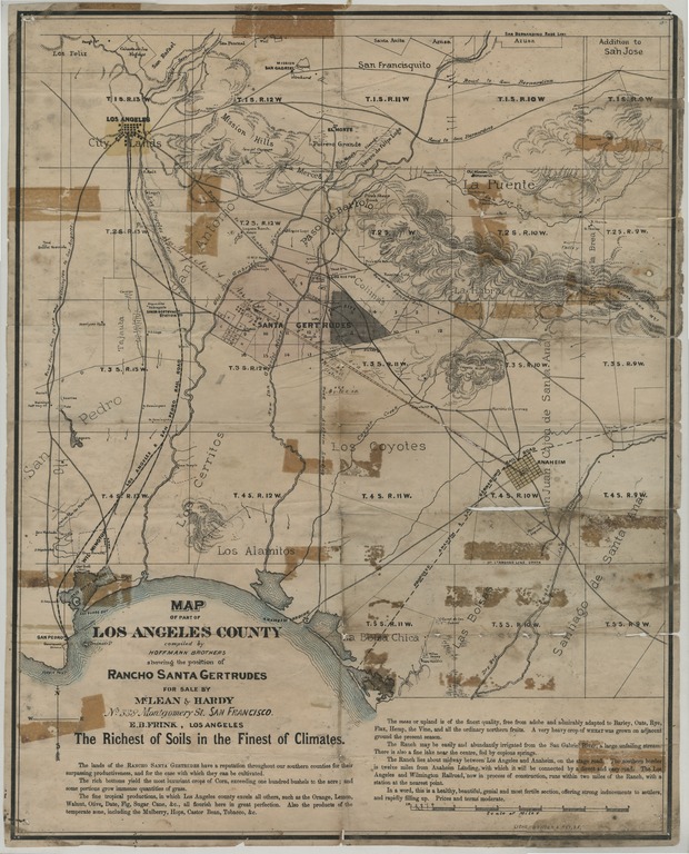
Map of part of Los Angeles County : showing the position of Rancho Santa Gertrudes, for sale by McLean & Hardy, No. 338 Montgomery St, San Francisco

- Creation Date
- between 1872 and 1891?
- Creator
- Former Owner
- Physical Description
-
1 map ; 48 x 38 cm
- Material Details
-
cartographic image
- Note
-
Relief shown by hachures
Shows section numbers, Los Angeles & San Pedro Rail Road, and proposed Anaheim & San Bernardino Rail Road
- Geographics
- Genre
- Corporate Name
- Topic
Format
View formats within this collection
- Language
- English
- Statement Of Responsibility
-
compiled by Hoffman Brothers
- Publication
-
Los Angeles [Calif.], E.B. Frink
- Copyright
-
Public domain (US)
Use: This work is available from the UC San Diego Library. This digital copy of the work is intended to support research, teaching, and private study.
Constraint(s) on Use: This work may be used without prior permission.
- Digital Object Made Available By
-
Special Collections & Archives, UC San Diego, La Jolla, 92093-0175 (https://lib.ucsd.edu/sca)
- Last Modified
2020-10-26