Eastern archipelago : anchorages on the south coast of Celebes

- Collection
- Description
-
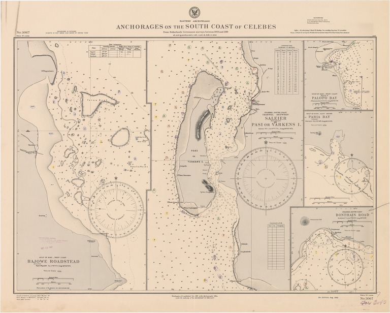
Gulf of Boni-west coast, Bajowe (Bajoa) Roadstead; Celebes-south coast, channel between Saleier (Salayar) and Pasi or Varkens I.; Gulf of Boni-west coast, sketch of Palopo Bay; Gulf of Boni-east shore, Paria (Sopang) Bay
- Creation Date
- 1932-08-01
- Date Issued
- 1940-10-01
- Publisher
- Note
-
From Netherlands government surveys between 1901 and 1918
Inset: Celebes-south coast, Bonthain Road
Relief shown by contours, landform drawings and spot heights; depths shown by soundings and isolines
- Geographics
- Topics
- Cartographics
Polygon: -2.952777778,119.9111111 -2.952777778,121.6611111 -6.275,121.6611111 -6.275,119.9111111 -2.952777778,119.9111111
Formats
View formats within this collection
- Language
- No linguistic content; Not applicable
- Series
-
5th edition, No. 3067
- Copyright
-
Public Domain (US)
Use: This work is available from the UC San Diego Library. This digital copy of the work is intended to support research, teaching, and private study.
Constraint(s) on Use: This work may be used without prior permission.
- Digital Object Made Available By
-
UC San Diego Library, UC San Diego, La Jolla, CA 92093-0175 (https://library.ucsd.edu/dc/contact)
- Last Modified
2022-11-02