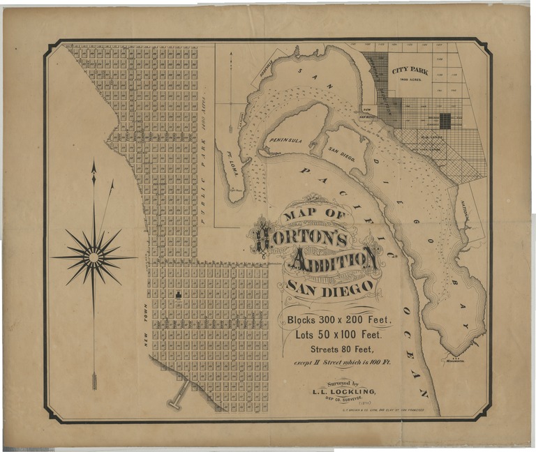
Map of Horton's Addition, San Diego : [Calif.]
![Map of Horton's Addition, San Diego : [Calif.]](/dc/object/bb5941391k/_3.jpg "Map of Horton's Addition, San Diego : [Calif.]")
- Collection
- Creation Date
- 187-?
- Creator
- Publisher
- Physical Description
-
1 map ; 50 x 58 cm
- Material Details
-
cartographic image
- Note
-
Cadastral map
Covers area bounded generally by Upas, [6th], A, [15th], N [i.e. Commercial], and Front Streets
Inset: [Map of San Diego showing location of Horton's Addition]
Shows block and lot numbers, named streets, wharf, etc
Special Collections copy formerly owned by John B. Goodman, III
- Geographic
- Genre
- Topic
Format
View formats within this collection
- Identifier
-
Mms: 991000022369706535
- Publication
-
San Francisco, G.T. Brown & Co. Lith.
- Copyright
-
Public domain (US)
Use: This work is available from the UC San Diego Library. This digital copy of the work is intended to support research, teaching, and private study.
Constraint(s) on Use: This work may be used without prior permission.
- Digital Object Made Available By
-
Special Collections & Archives, UC San Diego, La Jolla, 92093-0175 (https://lib.ucsd.edu/sca)
- Last Modified
2024-07-20