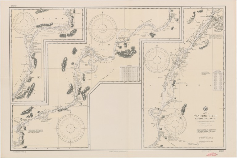
Asia : China : Yangtze River : Nanking to Tungliu

- Collection
- Creation Date
- 1925-08-01
- Date Issued
- 1930-07-01
- Publisher
- Note
-
From British and other surveys to 1913 with additions to 1923 from Chinese Maritime Customs surveys
Relief shown by hachures and spot heights; depths shown by soundings and isolines
- Geographics
- Topics
- Cartographics
Polygon: 32.14583333,116.7819444 32.14583333,118.8277778 30.04861111,118.8277778 30.04861111,116.7819444 32.14583333,116.7819444
Formats
View formats within this collection
- Language
- No linguistic content; Not applicable
- Series
-
5th edition, No. 3183
- Digital Origin
-
reformatted digital
- Copyright
-
Public Domain (US)
Use: This work is available from the UC San Diego Library. This digital copy of the work is intended to support research, teaching, and private study.
Constraint(s) on Use: This work may be used without prior permission.
- Digital Object Made Available By
-
UC San Diego Library, UC San Diego, La Jolla, CA 92093-0175 (https://library.ucsd.edu/dc/contact)
- Last Modified
2022-11-02