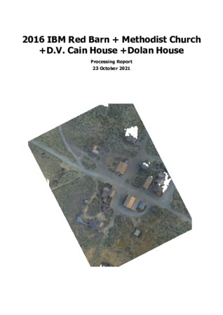
Red Barn + Methodist Church + D.V. Cain House + Dolan House
Thumbnail
| Technical Details | Screenshot of mesh 3D model displayed in Metashape. |
Embed
Embed URL
Embed Image
2016 Red Barn + Methodist Church + D.V. Cain House + Dolan House Control data
| Description | Dataset includes the geospatial control data collected at the Methodist Church + D.V. Cain House + Dolan House site by California State Parks surveyors during field season 2016. |
Control data for Point Clouds
| File Size |
|
| File Format |
|
| Description | Control data optimized for point clouds. |
| Data Contributor | |
| Technical Details | Spreadsheet listing the coordinates of the arbitrary markers/Ground Control Points created in Metashape. Data are stored in comma separated value format. |
2016 Red Barn + Methodist Church + D.V. Cain House + Dolan House IBM data
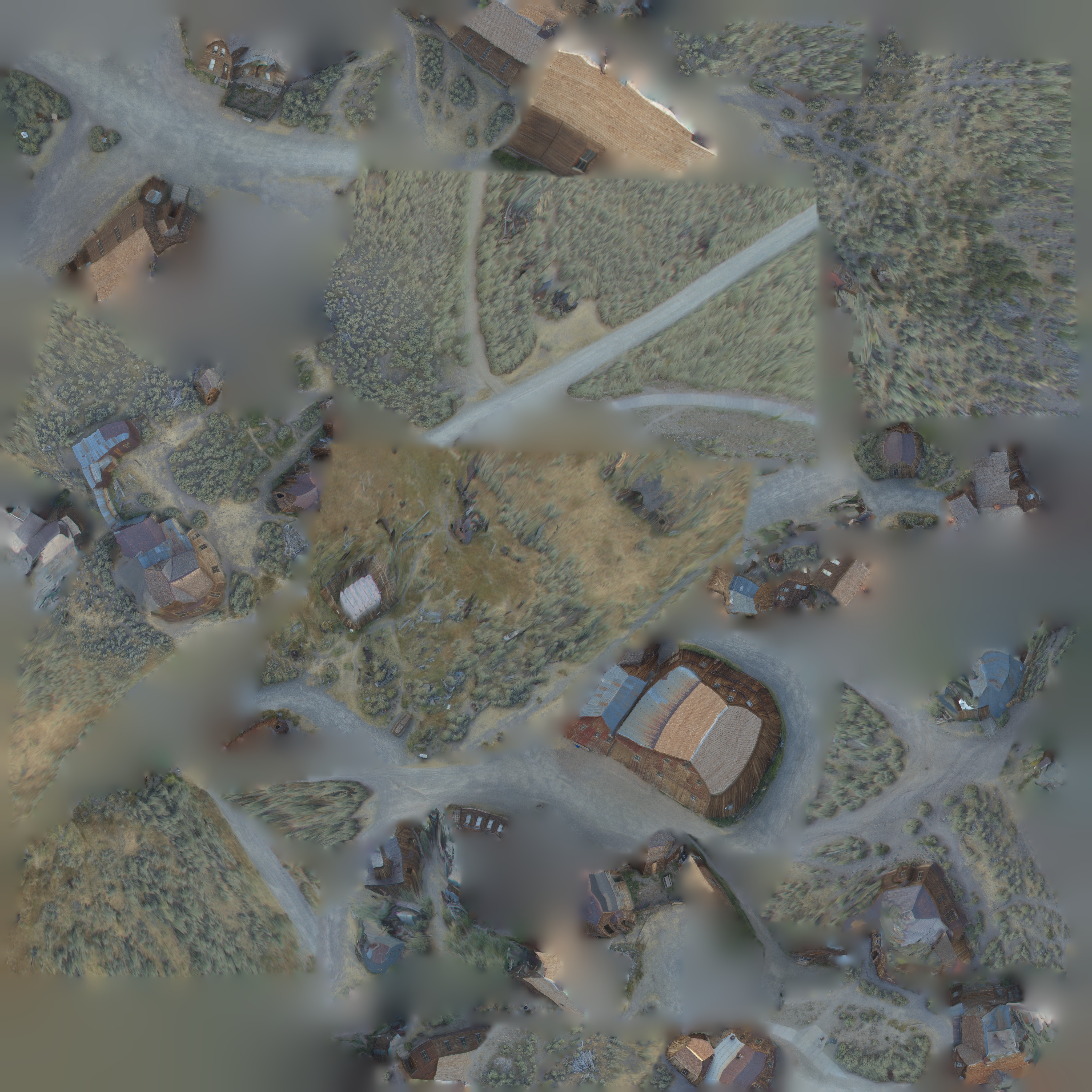
| Description | Image-based modeling dataset covering a small area around the Red Barn + Methodist Church + D.V. Cain House + Dolan House buildings located along Green St. and nearby streets. |
| Principal Investigators | |
| Technical Details | Includes natively digital data and derivative data produced using the Image-based modeling technique. |
Base Imagery
| File Size |
|
| File Format |
|
| Description | Archive including all of the aerial photos utilized to generate the dataset. |
| Data Contributors | |
| Technical Details | Compressed Zip archive including all of the photos used in the IBM processing for this dataset. |
3D Model
| File Size |
|
| File Format |
|
| Description | Wavefront OBJ 3D model. |
| Technical Details | Geometry stored as a list of points and edges in Wavefront OBJ 3D model. UV mapping coordinates included. This format is supported by most 3D modeling and 3D editing software apps, and game engines (i.e., Unity 3D, Unreal). |
3D Model Material
| File Size |
|
| File Format |
|
| Description | Material file linking the vertices and edges in the OBJ file to the texture atlas. |
| Technical Details | Text file linking the vertices and edges in the OBJ file to the related texture atlas. |
3D Model Texture Jpg
| Description | Texture atlas linked to the OBJ model. JPG format. |
| Technical Details | Color map (RGB). JPG compressed format. |
Embed
Embed URL
Embed Image
3D Model Texture Exr
| File Size |
|
| File Format |
|
| Description | Texture Atlas linked to the OBJ model. EXR open format. |
| Technical Details | Color map (RGB). EXR open format. |
IBM Point Cloud
| File Size |
|
| File Format |
|
| Description | 3D Point cloud in LAZ compressed format. |
| Technical Details | 3D point cloud suitable for visualization in point cloud viewers (i.e., Potree Viewer, 3D Hop) or point cloud editing software (i.e., CloudCompare). |
Digital Elevation Model
| File Size |
|
| File Format |
|
| Description | Digital Elevation Model in GeoTiff format. |
| Technical Details | DEM in GeoTiff format suitable for visualization and processing in a GIS. |
Orthomap
| File Size |
|
| File Format |
|
| Description | Orthophoto in GeoTiff format. |
| Technical Details | Orthophoto in GeoTiff format suitable for visualization in CAD and GIS. |
IBM Report
| File Size |
|
| File Format |
|
| Description | Image-based Modeling Metashape Report. |
| Technical Details | Metashape Report including detail on data acquisition and Image-based modeling data processing. |
2020 Methodist Church TLS data
| Description | Terrestrial Lidar dataset documenting the Methodist Church an iconic religious structure located on Green St. Scans were captured in the 2020 field season. |
| Analyst | |
| Data Contributor | |
| Technical Details | Includes digitally native and derivative data produced using the Terrestrial Laser Scanning technique. |
Raw Scans
| File Size |
|
| File Format |
|
| Description | Archive including all of the raw scans utilized to generate the dataset. |
| Technical Details | Compressed Zip archive including all the raw scans captured. The TLS scans were captured using a FARO Focus 3d S120 stationary range finder. The TLS scans were registered using FARO Scene 2019 software. No classification was performed. |
TLS point cloud
| File Size |
|
| File Format |
|
| Description | 3D Point cloud generated in FARO Scene by filtering, aligning, and segmenting the raw TLS scans documenting the site. |
| Technical Details | TLS pointcloud documenting the Methodist ChurchHoist building. LAZ format is supported by most point cloud viewers and editing apps. This dataset is not georeferenced. |
TLS Registration Report

| File Size |
|
| File Format |
|
| Description | Terrestrial Laser Scanning FARO Scene Registration Report. |
| Technical Details | FARO Scene Registration Report including detail on scans alignment and registration. |
- Collection
- Cite This Work
-
Lercari, Nicola; Jaffke, Denise; Aboulhosn, Jad; Anderson, Andreas (2021). Red Barn + Methodist Church + D.V. Cain House + Dolan House. In Data from: Building Cultural Heritage Resilience through Remote Sensing: An Integrated Approach using Multi-temporal Site Monitoring, Datafication, and Web-GL Visualization. UC San Diego Library Digital Collections. https://doi.org/10.6075/J0CN73NT
- Description
-
Dataset includes all the natively digital geospatial and 3D data collected in our topographic and 3D survey of a downtown area along Green St. including the Methodist Church, the Red Barn, the D.V. Cain House, and the Dolan House.
- Date Collected
- 2016 and 2020
- Date Issued
- 2021
- Principal Investigators
- Data Contributors
- Technical Details
-
The IBM 3D models and derivative products were generated via a typical Image-based modeling pipeline. The aerial photos were collected by the UC Merced team using a DJI Phantom 3 Pro multi-rotor drone. No geospatial control was collected in the field, so the model was georeferenced using arbitrary markers/GCPs and the Bodie townsite dataset as a reference.
- Funding
-
Cal Parks WO #13-203732-00 and supplement WO #13-203732-00R3, RLF Grant #2013-0387, UCOP CITRIS Seed Grant 2016
- Geographics
- Topic
- Cartographics
Point: 38.212350, -119.014259
Formats
View formats within this collection
- Language
- English
- Identifier
-
Denise Jaffke: https://orcid.org/0000-0002-7974-2167
Nicola Lercari: https://orcid.org/0000-0002-8122-1440
- Related Resource
- Lercari, N.; Jaffke, D.; Campiani, A.; Guillem, A.; McAvoy, S.; Jiménez Delgado, G.; Bevk Neeb, A. Building Cultural Heritage Resilience through Remote Sensing: An Integrated Approach using Multi-temporal Site Monitoring, Datafication, and Web-GL Visualization. Remote Sens. 2021, 13, 20. https://doi.org/10.3390/rs13204130
Primary associated publication
- License
-
Creative Commons Attribution-NonCommercial 4.0 International Public License
- Rights Holder
- UC Regents
- Copyright
-
Under copyright (US)
Use: This work is available from the UC San Diego Library. This digital copy of the work is intended to support research, teaching, and private study.
Constraint(s) on Use: This work is protected by the U.S. Copyright Law (Title 17, U.S.C.). Use of this work beyond that allowed by "fair use" or any license applied to this work requires written permission of the copyright holder(s). Responsibility for obtaining permissions and any use and distribution of this work rests exclusively with the user and not the UC San Diego Library. Inquiries can be made to the UC San Diego Library program having custody of the work.
- Digital Object Made Available By
-
Research Data Curation Program, UC San Diego, La Jolla, 92093-0175 (https://lib.ucsd.edu/rdcp)
- Last Modified
2022-07-14