Eastern archipelago : plans in Flores Sea

- Collection
- Description
-
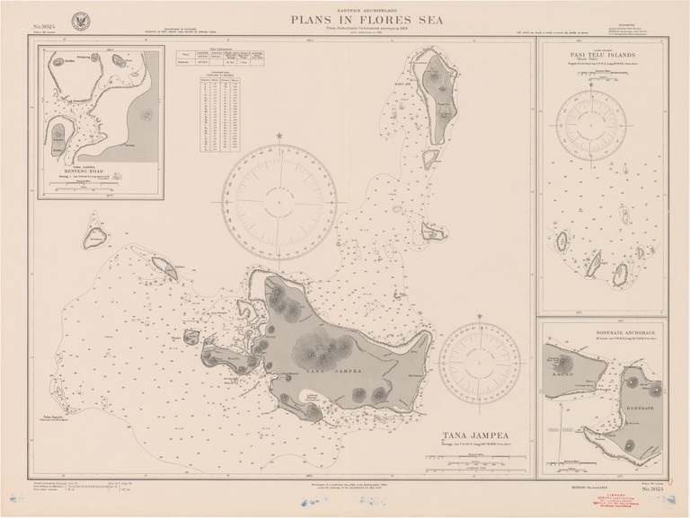
Tana Jampea
- Creation Date
- 1923-06-01
- Date Issued
- 1941-07-01
- Publisher
- Note
-
From Netherlands government surveys in 1903 with additions to 1921
Inset: Tana Jampea, Benteng Road; Tiger Islands, Pasi Telu Islands (Kassi Tallu); Bonerate anchorage
Relief shown by contours, landform drawings and spot heights; depths shown by soundings and isolines
- Geographics
- Topics
- Cartographics
Polygon: -6.766666667,120.3833333 -6.766666667,121.1666667 -7.416666667,121.1666667 -7.416666667,120.3833333 -6.766666667,120.3833333
Formats
View formats within this collection
- Language
- No linguistic content; Not applicable
- Series
-
3rd edition, No. 3024
- Digital Origin
-
reformatted digital
- Copyright
-
Public Domain (US)
Use: This work is available from the UC San Diego Library. This digital copy of the work is intended to support research, teaching, and private study.
Constraint(s) on Use: This work may be used without prior permission.
- Digital Object Made Available By
-
UC San Diego Library, UC San Diego, La Jolla, CA 92093-0175 (https://library.ucsd.edu/dc/contact)
- Last Modified
2022-11-02