Eastern archipelago : plans in the northern part of the Halmahera Group

- Collection
- Description
-
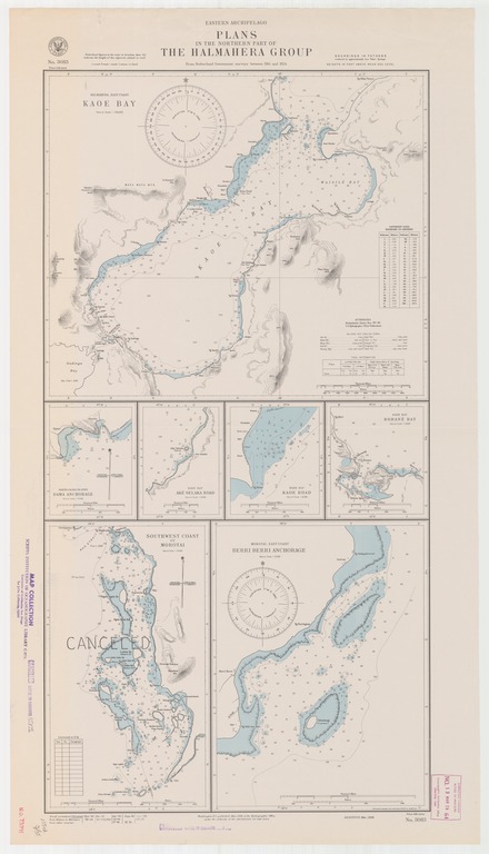
Halmahera-east coast, Kaoe Bay; North Loloda Islands, Dama anchorage; Kaoe Bay, Ake Selaka Road; Kaoe Bay, Kaoe Road; Kaoe Bay, Bobane Road; Southwest coast of Morotai; Morotai-east coast, Berri Berri anchorage
- Creation Date
- 1938-03-01
- Date Issued
- 1950-09-01
- Publisher
- Note
-
From Netherlands government surveys between 1914 and 1924
Relief shown by contours and spot heights; depths shown by soundings and isolines
- Geographics
- Topics
- Cartographics
Polygon: 2.427777778,127.5458333 2.427777778,128.7027778 0.766666667,128.7027778 0.766666667,127.5458333 2.427777778,127.5458333
Formats
View formats within this collection
- Language
- No linguistic content; Not applicable
- Series
-
1st edition, No. 3083
- Digital Origin
-
reformatted digital
- Copyright
-
Public Domain (US)
Use: This work is available from the UC San Diego Library. This digital copy of the work is intended to support research, teaching, and private study.
Constraint(s) on Use: This work may be used without prior permission.
- Digital Object Made Available By
-
UC San Diego Library, UC San Diego, La Jolla, CA 92093-0175 (https://library.ucsd.edu/dc/contact)
- Last Modified
2022-11-02