Browse by Collection: UCSD Research Data Collections
View current collections below. Click an image or link for a full description.
Page 5 of 11
Search Results
-
 Collection
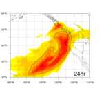
Western Pacific Atmospheric River Object Data from MODE detection software using West-WRF, GEFS, and MERRA-2
- The collection contains NetCDF files of atmospheric river objects as processed through the Method for Object-based Diagnostic Evaluation software.
- Date: 2006-12 to 2017-03
-
 Collection
Data from: Soft robotic steerable micro-catheter for the endovascular treatment of cerebral disorders
- Results of analysis and experiment on steerable microcatheters and microguidewires, including video and raw data.
- Date: 2017-01-01 to 2021-06-30
-
 Collection
The Cross-Surfzone/Inner-shelf Dye Exchange (CSIDE) Study
- Observational data and analysis from the NSF-funded Cross-Surfzone/Inner-shelf Dye Exchange (CSIDE) Study.
- Date: 2015
-
 Collection
Scripps Ecological Observatory
- Flow cytometry and dissolved gas data (oxygen and argon) collected at the Ellen Browning Scripps Pier.
- Date: 2019 to present
-
 Collection
Data from: Cyclic(Alkyl)(Amino)Carbene Ligands Enable Cu-Catalyzed Markovnikov Protoboration and Protosilylation of Terminal Alkynes: A Versatile Portal to Functionalized Alkenes
- Included are the Gaussian output files (.chk, .fchk, and .log) from DFT calculations on the free carbenes explored in the protoboration and protosilylation of alkynes.
- Date: 2020 to 2021
-
 Collection
Data from: The Oceanic Barrier Layer in the Eastern Indian Ocean as a Predictor for Rainfall over Indonesia and Australia
- This collection consists of E3SMv0 model and variety of observational data and scripts in support of relevant manuscript focused on the relationship of the barrier layer in a region West of Sumatra and the terrestrial rainfall over Indonesia and Australia.
- Date: 2018 to 2020
-
 Collection
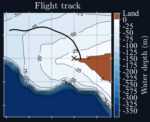
Data from: Observations of strongly modulated surface wave and wave breaking statistics at a submesoscale front
- This collection contains data presented in Vrecica et al 2021, including an overview of a submesoscale front, wave statistics, and wave breaking statistics.
- Date: 2018-04-17
-
 Collection
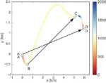
Data from: Eddy-induced acceleration of Lagrangian floats
- Simulated Argo float positions computed using velocities from the Estimating the Circulation and Climate of the Ocean, Phase II (ECCO2) project.
- Date: 2016 to 2019
-
 Collection
San Diego Supercomputer Center (SDSC) Research Data Services Materials Collection
- Research Data Services (RDS) division at SDSC provides infrastructure and technical expertise to support data-intensive research for academic and non-academic customers. This collection includes informational and technical work materials developed for the teams’ many projects.
- Date: 2019 to present
-
 Collection
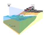
Data from: Enhanced surf zone and wave runup observations with hovering drone-mounted LiDAR
- Drone LiDAR data obtained during the SCaRP field experiment of Winter 2019-2020 at Torrey Pines State Beach in San Diego, California, USA.
- Date: 2019-12-14 to 2020-02-24
-
 Collection
Data from: Technical Note: Stability of tris pH buffer in artificial seawater stored in bags
- pH and total dissolved inorganic carbon measurements from tris buffer in artificial seawater stored in gas impermeable bags.
- Date: 2018-05-24 to 2019-12-20
-
 Collection
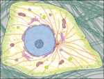
Cell Image Library
- This library is a public and easily accessible resource database of images, videos, and animations of cells, capturing a wide diversity of organisms, cell types, and cellular processes. The purpose of this database is to advance research on cellular activity, with the ultimate goal of improving human health.
- Date: 2010-08-09 to present
-
 Collection
Daily POP Model Output over the Equatorial Indian Ocean
- Daily POP Model output (2005-2009) extracted over the equatorial Indian Ocean.
- Date: 2005 to 2009
-
 Collection
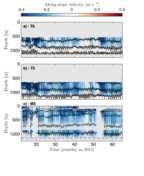
Data from: Internal tide structure and temporal variability on the reflective continental slope of southeastern Tasmania
- This collection contains in situ data (from 3 moorings and 1 CTD/LADCP station) from the Tasman Tidal Dissipation Experiment (T-TIDE) that was analyzed in Marques et al. (2020).
- Date: From 2015-01 to 2015-03
-
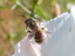 Collection
Native bees in San Diego's coastal sage scrub reserves and fragments, surveyed in 2015 and 2016
- A dataset of bees and plants in coastal sage scrub reserves and habitat fragments in coastal San Diego County, collected by PhD student Keng-Lou James Hung in 2015 and 2016.
- Date: 2015 to 2016
-
 Collection
Data from: Feasibility of continuous fever monitoring using wearable devices
- Sixty-five continuous days of data at one-minute resolution covering fifty individuals reporting COVID-19 infections starting on day 45 in the data set.
- Date: 2020-03 to 2020-06
-
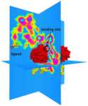 Collection
Data from: Multiscale Simulations Examining Glycan Shield Effects on Drug Binding to Influenza Neuraminidase
- The input and output Brownian dynamics trajectories associated with this study.
- Date: 2017 to 2020
-
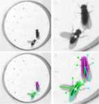 Collection
Data from: Quantifying influence of human choice on the automated detection of Drosophila behavior by a supervised machine learning algorithm
- This data collection contains original movie files, files derived from a tracking program (FlyTracker) and a machine learning-based behavioral classification suite (JAABA), and behavior classifiers for Drosophila social behaviors. These constitute source data of our publication (Leng, X., et al., 2020, in press). With our custom codes (available at https://github.com/asahinak/Leng_Wohl_etal_2020_JAABA_vs_human_annotation), readers can reproduce all the results presented in the article.
- Date: 2015-03 to 2018-09
-
 Collection
Exploring Earth by Scientific Ocean Drilling: 2050 Science Framework
- The "2050 Science Framework: Exploring Earth by Scientific Ocean Drilling" guides scientists on important research frontiers to pursue to increase understanding of the Earth system while addressing natural and human-caused issues facing society.
- Date: 2020
-
 Collection
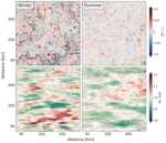
Data from: Wave-Current Interactions at Meso and Submesoscales: Insights from Idealized Numerical Simulations
- This collection contains output from idealized simulations of wave-current interactions produced using the wave model WAVEWATCH III and analyzed by Villas Bôas et al. (2020) [doi:10.1175/JPO-D-20-0151.1]. The data can be used in conjunction with the open-source code [https://github.com/biavillasboas/IdealizedWaveCurrent] to reproduce all figures in the paper.
- Date: 2019 to 2020
 Library Digital Collections