Eastern Archipelago : plans in Sumbawa Island

- Collection
- Description
-
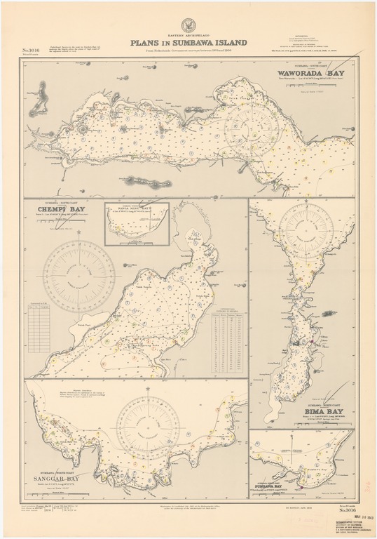
Sumbawa-south coast, Waworda Bay; Sumbawa-south coast, Chempi Bay; Sumbawa-north coast, Sanggar Bay; Sumbawa-north coast, Bima Bay; Sumbawa-north coast, Sumbawa Bay
- Creation Date
- 1919-06-01
- Date Issued
- 1940-10-01
- Publisher
- Note
-
From Netherlands Government surveys between 1904 and 1906
Inset: Sumbawa-north coast, Nanga Miru Bay
Relief shown by form lines and spot heights; depths shown by soundings and isolines
- Geographics
- Topics
- Cartographics
Polygon: -8.280555556,117.3541667 -8.280555556,119.0347222 -8.801388889,119.0347222 -8.801388889,117.3541667 -8.280555556,117.3541667
Formats
View formats within this collection
- Language
- No linguistic content; Not applicable
- Series
-
2nd edition, No. 3016
- Copyright
-
Public Domain (US)
Use: This work is available from the UC San Diego Library. This digital copy of the work is intended to support research, teaching, and private study.
Constraint(s) on Use: This work may be used without prior permission.
- Digital Object Made Available By
-
UC San Diego Library, UC San Diego, La Jolla, CA 92093-0175 (https://library.ucsd.edu/dc/contact)
- Last Modified
2022-11-02