Indonesia : plans in Borneo, Celebes and Muna

- Collection
- Description
-
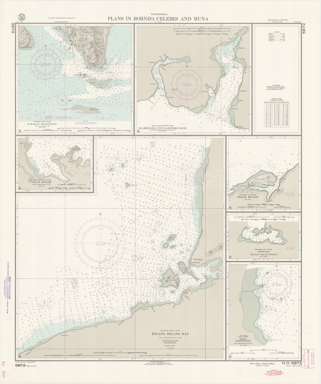
Borneo-east coast, Tarakan Roadstead; Muna Island-south coast, Wambololi and Lasongko Bay; Celebes-NW coast, Teluk Bulias; Celebes-NW coast, Dondo Bay, Teluk Pagalungian; Muna Island east coast, Raha Roadstead
- Creation Date
- 1951-07-01
- Date Issued
- 1958-11-24
- Publisher
- Note
-
From various surveys
Inset: Celebes-west coast, Belang Belang Bay; Celebes-east coast, Teluk Moramu
Relief shown by contours, landform drawings and spot heights; depths shown by soundings and isolines
- Geographics
- Topics
- Cartographics
Polygon: 3.316666667,117.5 3.316666667,122.75 -5.45,122.75 -5.45,117.5 3.316666667,117.5
Formats
View formats within this collection
- Language
- No linguistic content; Not applicable
- Series
-
2nd edition, No. 5872
- Copyright
-
Public Domain (US)
Use: This work is available from the UC San Diego Library. This digital copy of the work is intended to support research, teaching, and private study.
Constraint(s) on Use: This work may be used without prior permission.
- Digital Object Made Available By
-
UC San Diego Library, UC San Diego, La Jolla, CA 92093-0175 (https://library.ucsd.edu/dc/contact)
- Last Modified
2022-11-02