Aerial view of Navonda

- Collection
- Description
-
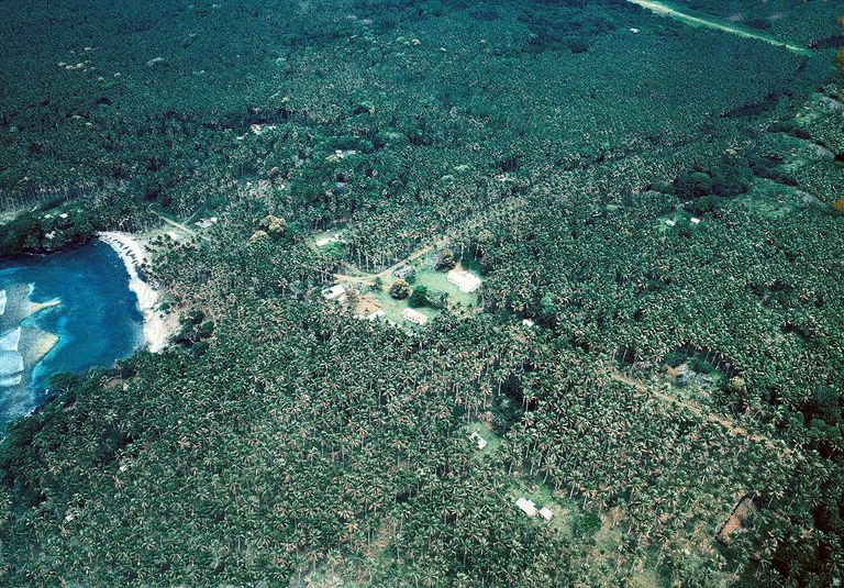
In an aerial view of the village of Navonda, St. Andrew's church can be seen and across the road is the Malawisi Council House. In the foreground and in the middle of the coconut plantations is the village of Tanavu. Also shown is the straight road running through Navonda, Gamal Bageo beach, and the airfield.
- Creation Date
- 1982
- Creators
- Note
-
Folder: 1982-Series1 / File: 82 8 Environ - Aerial View of Navonda.rev
- Geographics
- Topics
Format
View formats within this collection
- Language
- No linguistic content; Not applicable
- Identifier
-
Shared Shelf: 24355783
- Related Resource
Online finding aid
- Rights Holders
- Critchlow, Margaret
- Rodman, William L.
- Copyright
-
Under copyright (US)
Use: This work is available from the UC San Diego Library. This digital copy of the work is intended to support research, teaching, and private study.
Constraint(s) on Use: This work is protected by the U.S. Copyright Law (Title 17, U.S.C.). Use of this work beyond that allowed by "fair use" or any license applied to this work requires written permission of the copyright holder(s). Responsibility for obtaining permissions and any use and distribution of this work rests exclusively with the user and not the UC San Diego Library. Inquiries can be made to the UC San Diego Library program having custody of the work.
- Digital Object Made Available By
-
UC San Diego Library, UC San Diego, La Jolla, CA 92093-0175 (https://library.ucsd.edu/dc/contact)
- Last Modified
2021-11-16